I am currently writing a general science article about pyrodiversity in Californian ecosystems as part of my fellowship at Berkeley Institute for Data Science . I decided to extend the idea to write a small grant to the National Geographic Society for funding a field component in the Klamath Mountain range in Northern California and Southern Oregon. The grant opportunity combines many of my current skills to tell a pyrodiversity story. The idea would be to explore areas of high, medium, and low pyrodiversity by human power starting from my house in Mount Shasta, CA and ending in Crescent City, CA. I have a few potential routes mapped out, but the one displayed below starts with a bikepacking route between Mount Shasta and Junction City, CA. The route then transitions to backpacking and takes a slightly modified version of the Bigfoot Trail. Fingers crossed for next year!
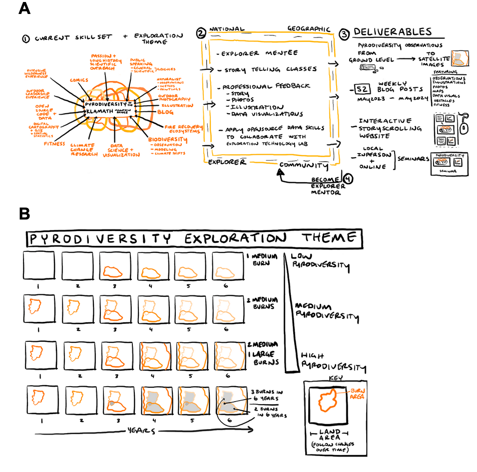
Figure 1A - Project overview with four major steps. The project will take my current diverse skill set and exploration theme (1) and allow me to be mentored and learn from the National Geographic Explorer Community (2) to produce the proposed deliverables (3). I will then give back to the Explorer community by becoming a mentor and applying my open-source data science skills to collaborate with the technical teams at National Geographic (4).
Figure 1B - A graphic representation of pyrodiversity concepts. Burn areas (orange) are represented within land areas. Overlapping fires occur over years (left to right). Examples of low pyrodiversity (few fires) to high pyrodiversity (many overlapping fires) are illustrated top to bottom.
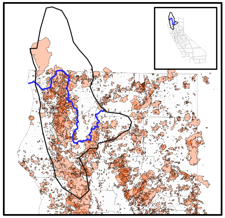
Figure 2- Inlay- Map of California (gray) with approximate outline of Klamath Mountains (black) and proposed backcountry route (blue). Zoomed in map of Klamath Mountains (black) of Northern California (gray) with proposed backcountry route (blue). Overlayed in transparent orange are the fire perimeters of the last 100 years. The deeper the orange color, the greater the number of fires for a given area. The proposed route will explore areas of high, medium and low pyrodiversity.