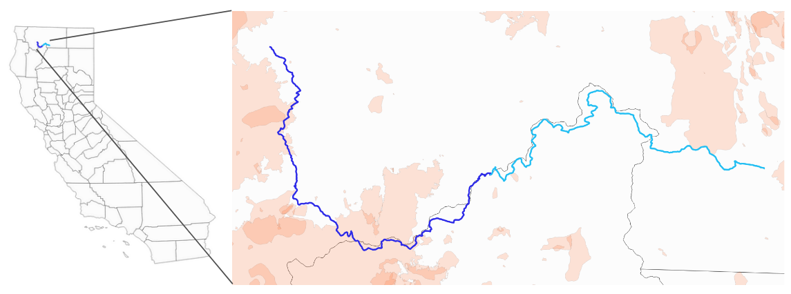
We planned back to back ultra-runs from our hometown of Mount Shasta, CA up into the Klamath range. I wanted to balance the ease of running using established trails as much as possible with running through areas that have burned in the last 100 years. An additional constraint was road access and camping for our crew. The light blue is the first day and the dark blue is the second day. The orange outlines are fire scars from the last 100 years (Data Source, CALFIRE). In the next few posts in this series I will talk about the fire history of each of the many fire scars we ran by or directly through and what story they have to tell about the pyroscape in my backyard.
DAY 1
Thursday August 3 - Mount Shasta to Scott Mountain Campground
39 miles - +6335/-4501 (feet gain/loss)
Trails: Sission Trail to PCT Northbound
Midway Stop: Parks Creek PCT Trailhead
DAY 2
Friday August 4 - Scott Mountain to Etna Summit
39 miles - (+7826/-7289)
Trail:PCT Northbound
Midway Stop: Scott Mountain to Hidden Lake Trail - 30 minute drive
Directions from Hidden Lake to Etna Summit - 54 minute drive